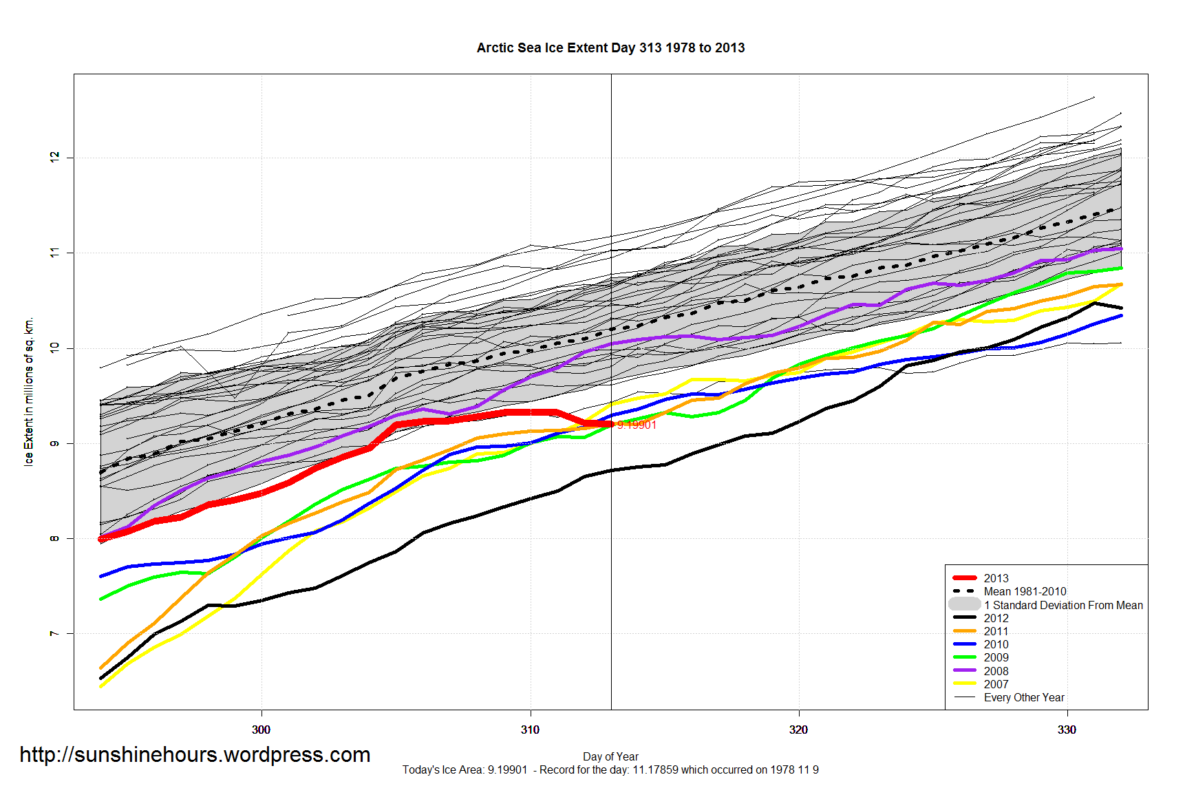
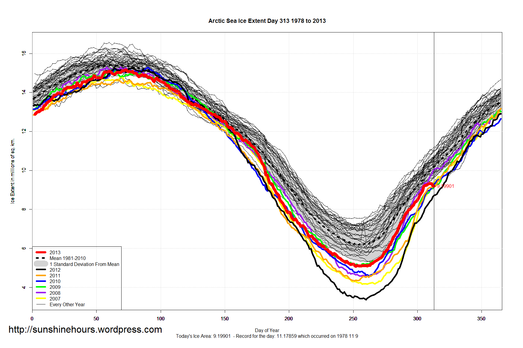
Very strange goings on in the arctic. It looks very dramatic in the bottom graph.
Possibly this monstrous tropical cyclone that smashed in the Bering Sea?
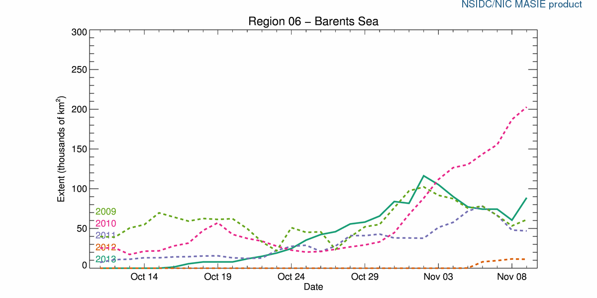
Update: Barents Sea Ice did take a tumble starting Nov 2. Which is nowhere near the Bering Sea.

Is it of interest that this happened after the NSIDC blackout? I have confirmed with WMO that there was never a data interruption to NOAA so it must have been them. Cooking the books again?
Stuff happens. Satellites go bad without a conspiracy. Usually they admit up front if they are cooking the books and sort dare us to complain about it.
Interesting…I’ve been curious about the weather in the Barents/Kara Sea region which seems to have gone from 70% ice to mostly open water in the last week. I suppose this adds to the thickness near the new ice margins as ice gets pliled together at the margins?
The US Navy site animation for the Arctic shows a dramatic shift of ice cover north of Svalbard over the last few days although it now looks to be recovering to where it was.
The most recent image is at http://www7320.nrlssc.navy.mil/hycomARC/navo/arcticictnnowcast.gif also this one often seems a day behind the latets in the animation version.
Mick.
This may give more clues, looks like a powerful cyclone as mentioned in the blog. Animation could do with a speed control though.
The menu for these graphics is here http://www7320.nrlssc.navy.mil/hycomARC/arctic.html
Mick.
Thanks
DMI does pressure and temp graphics
http://ocean.dmi.dk/arctic/weather/arcticweather.uk.php
DMI showing a big depression over Western Arctic. This would push loads of ice back towards the Canadian coast.
http://ocean.dmi.dk/arctic/weather/arcticweather.uk.php