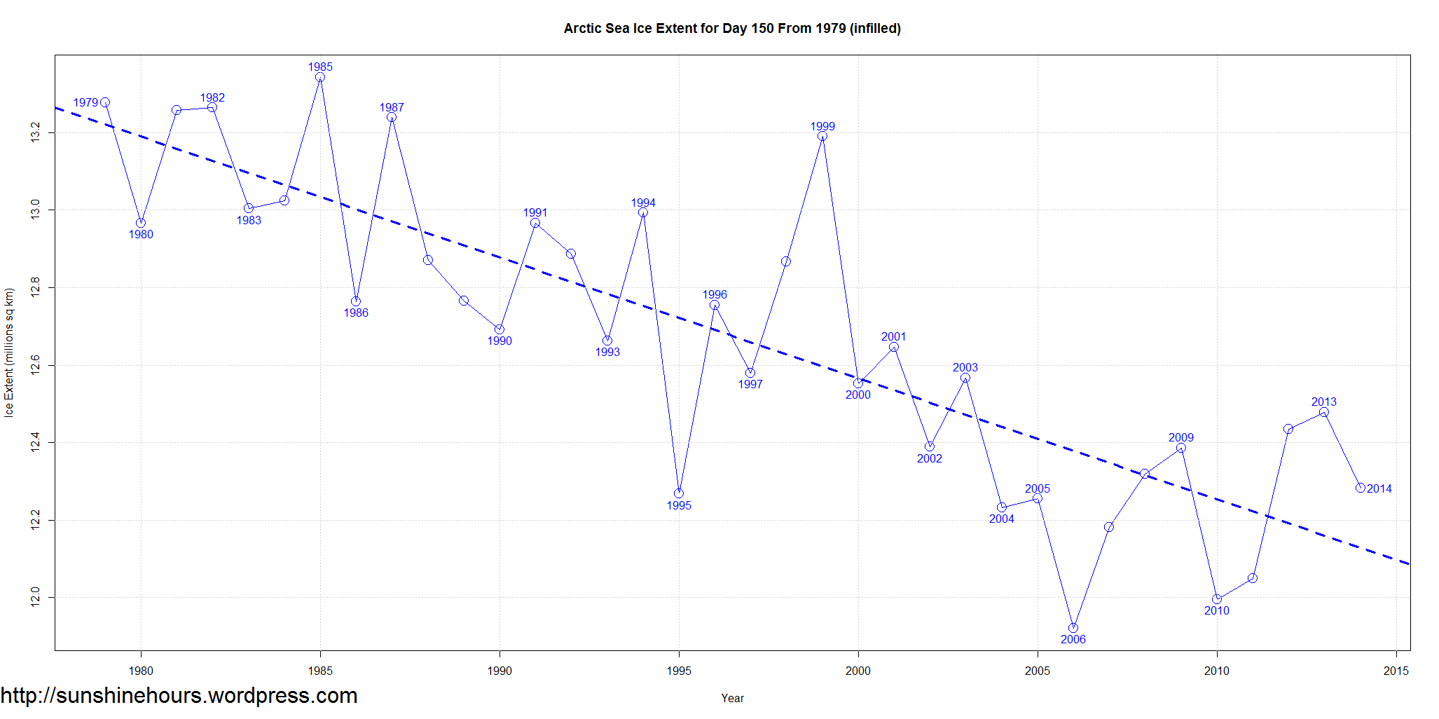
Yes there was an Arctic Sea Ice Extent Tipping Point.
It was 2006.
Arctic Sea Ice Extent For this Day from 1979
Arctic Sea Ice Extent For this Day from 2006
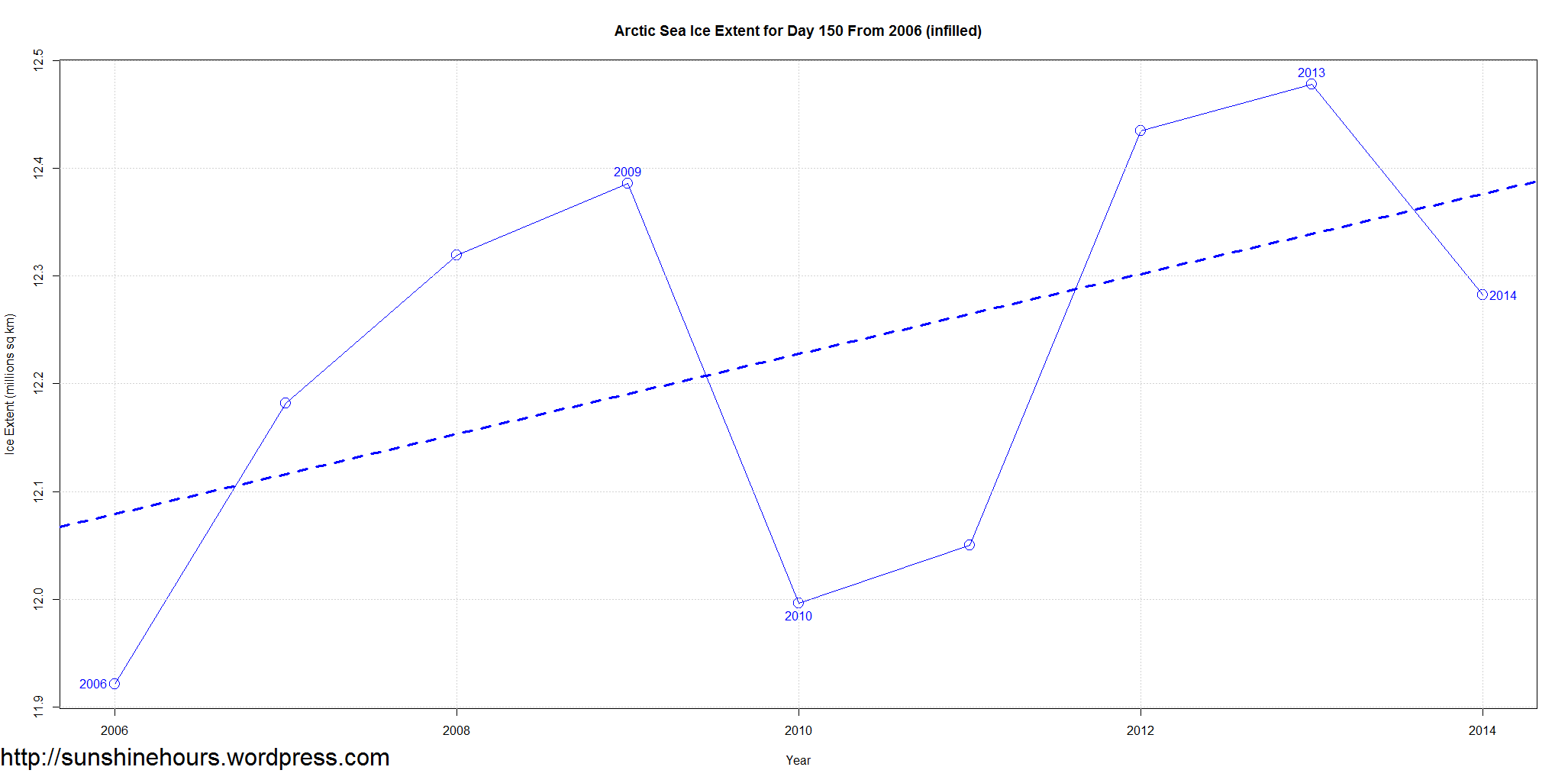
Yes there was an Arctic Sea Ice Extent Tipping Point.
It was 2006.
Arctic Sea Ice Extent For this Day from 1979
Arctic Sea Ice Extent For this Day from 2006

This one day observation looks like a trend change, but I don’t think it will hold up going forward.
MASIE showed the 2006 minimum at 6.52 MKm2, well above the last seven years average of 5.15 MKm2.
Given the lower max this year, the minimum is not likely to exceed last year’s 5.51 MKm2 by very much.
Of course if there is a major storm, as in 2012, then all bets are off. On the other hand, if there is less warm water coming up through the Canadian Archipelago, then a higher minimum is possible.
Either way, summer ice extent is all about warm water, not CO2 or warm air.
The AMO is due to change, The winter months have been flirting with negative values and this year the first 4 months are negative. The big change would be if the rest of the year goes negative.
http://www.esrl.noaa.gov/psd/data/correlation/amon.us.data