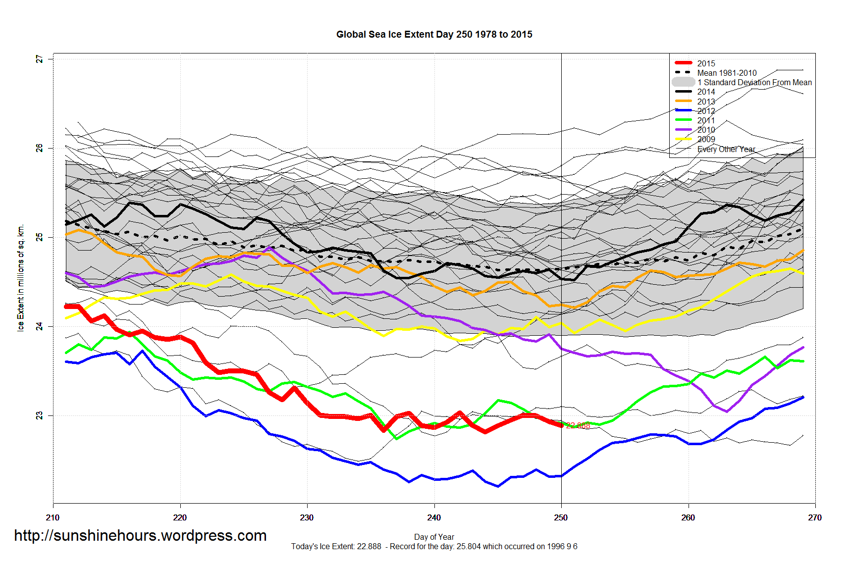
DMI and NOAA use the same passive microwave product from NASA but each has a processing algorithm. MASIE uses additional sources to make ice charts as a basis for extent estimates.
MASIE shows a new minimum while the Sept. Average first 7 Days holds on at 4.4M km2.

Hmm, why is there a difference between nsidc and DMI?
http://ocean.dmi.dk/arctic/icecover.uk.php
DMI and NOAA use the same passive microwave product from NASA but each has a processing algorithm. MASIE uses additional sources to make ice charts as a basis for extent estimates.
MASIE shows a new minimum while the Sept. Average first 7 Days holds on at 4.4M km2.
https://rclutz.wordpress.com/2015/09/08/arctic-ice-water-today/
Correction: the extent for Sept is 4.6M not 4.4M.
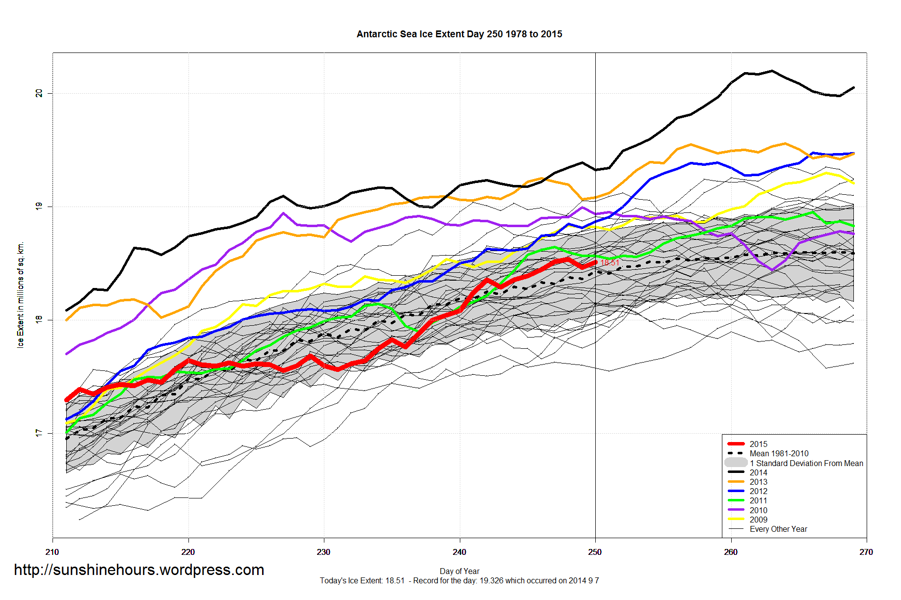
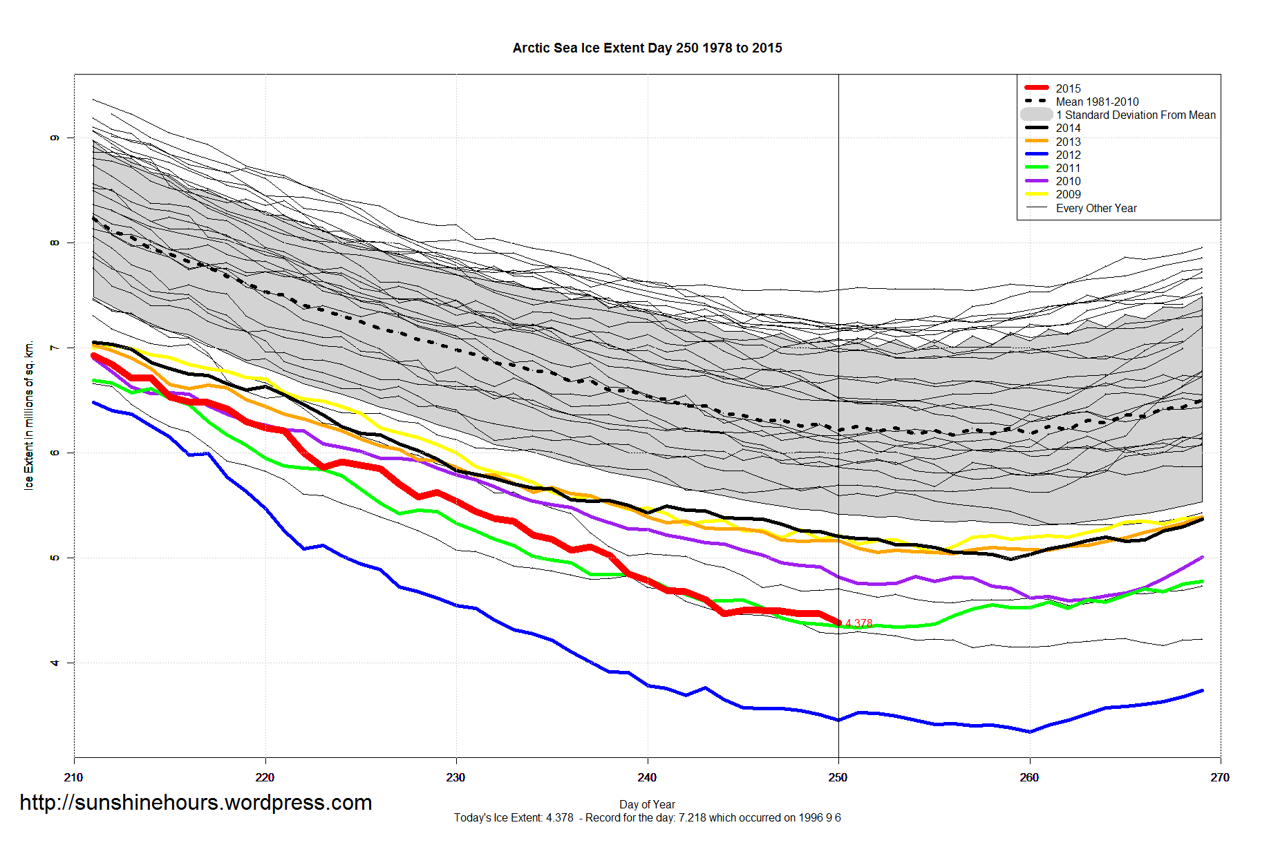
Central Arctic looks like it may have reached min ice already on Sep 1.
http://ozonewatch.gsfc.nasa.gov/Scripts/big_image.php?date=2015-09-04&hem=S&source=IOMI_PAURA_V8F_MGEOS5FP§ion=HOME