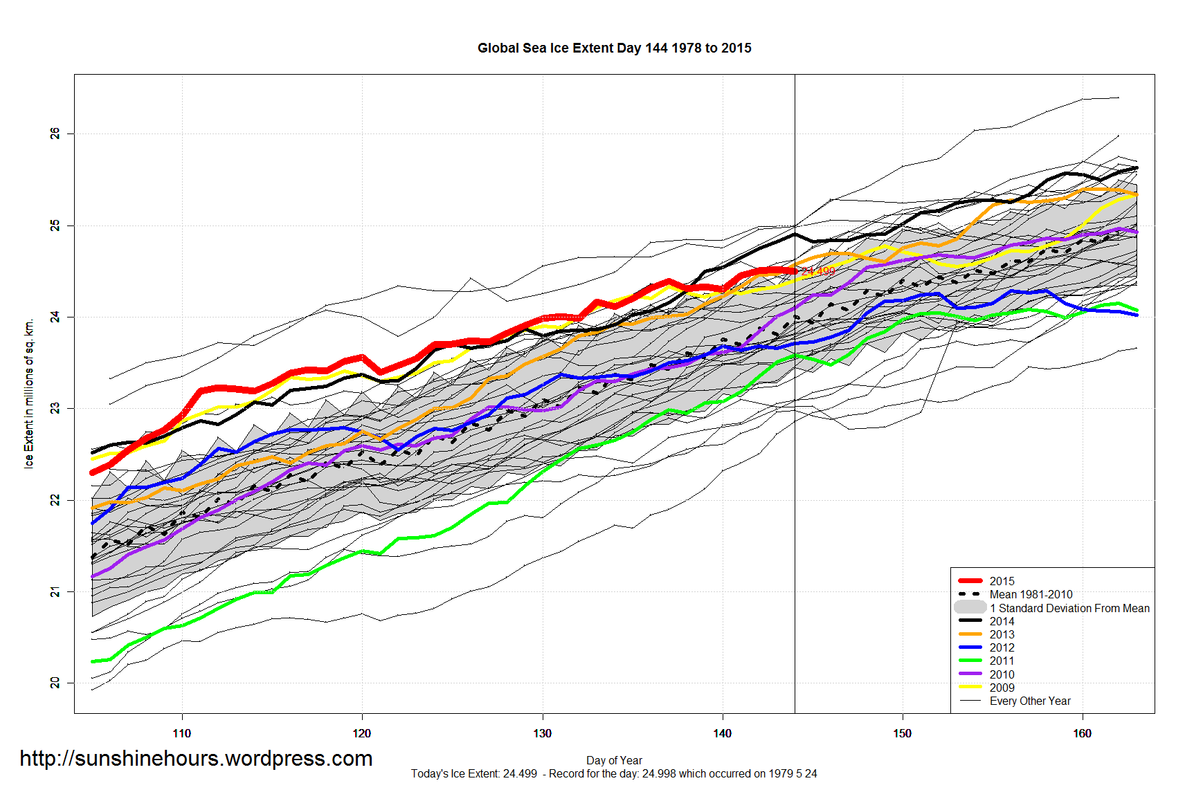
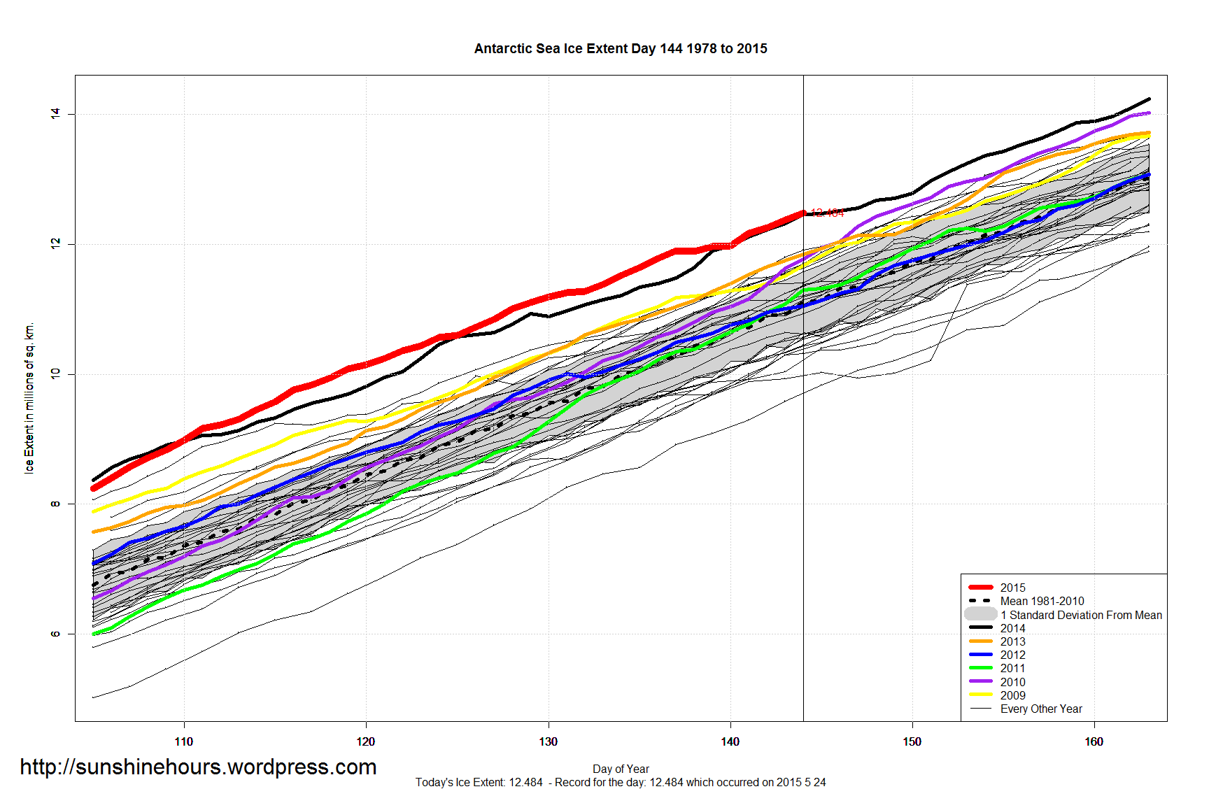
Sea Ice Extent – Day 144 – Antarctic Sets 55th Daily Record – 8th Highest Global Sea Ice For This Day Published on May 25, 2015 by sunshinehours1 8th Highest Global Sea Ice For This Day 55th Daily Record for Antarctic – 1.45 million above the 1981-2010 mean. – Above 2 standard deviations. Data: South / North Share this: Share on X (Opens in new window) X Share on Facebook (Opens in new window) Facebook Like Loading... Related
2015 Arctic ice extent keeps pace with 2014 despite the “Blob”. https://rclutz.wordpress.com/2015/05/12/arctic-ice-watch-2015-2/ Reply
Hi there. Please, don’t take my comment as an offense, I really just want to know, why is your Arctic info so much worse in relation to previous years than the official one from NOAA? Thanks in advance! Reply
I use an NOAA data product. IMS uses a different methodology and sensors. I believe IMS is more interested in ice edge. The NOAA product I use (ftp://sidads.colorado.edu/DATASETS/NOAA/G02135/north/daily/data) http://nsidc.org/data/seaice/data_summaries.html Reply
IMS is the same as MASIE, which stands for Multisensor Analyzed Sea Ice Extent, It includes microwave sensor results, but also satellite imagery and ship observations. This leads to some differences in numbers but similar patterns. The two histories are summarized here: https://rclutz.wordpress.com/2015/03/30/everything-you-wanted-to-know-about-measuring-arctic-ice-but-were-afraid-to-ask/ Reply
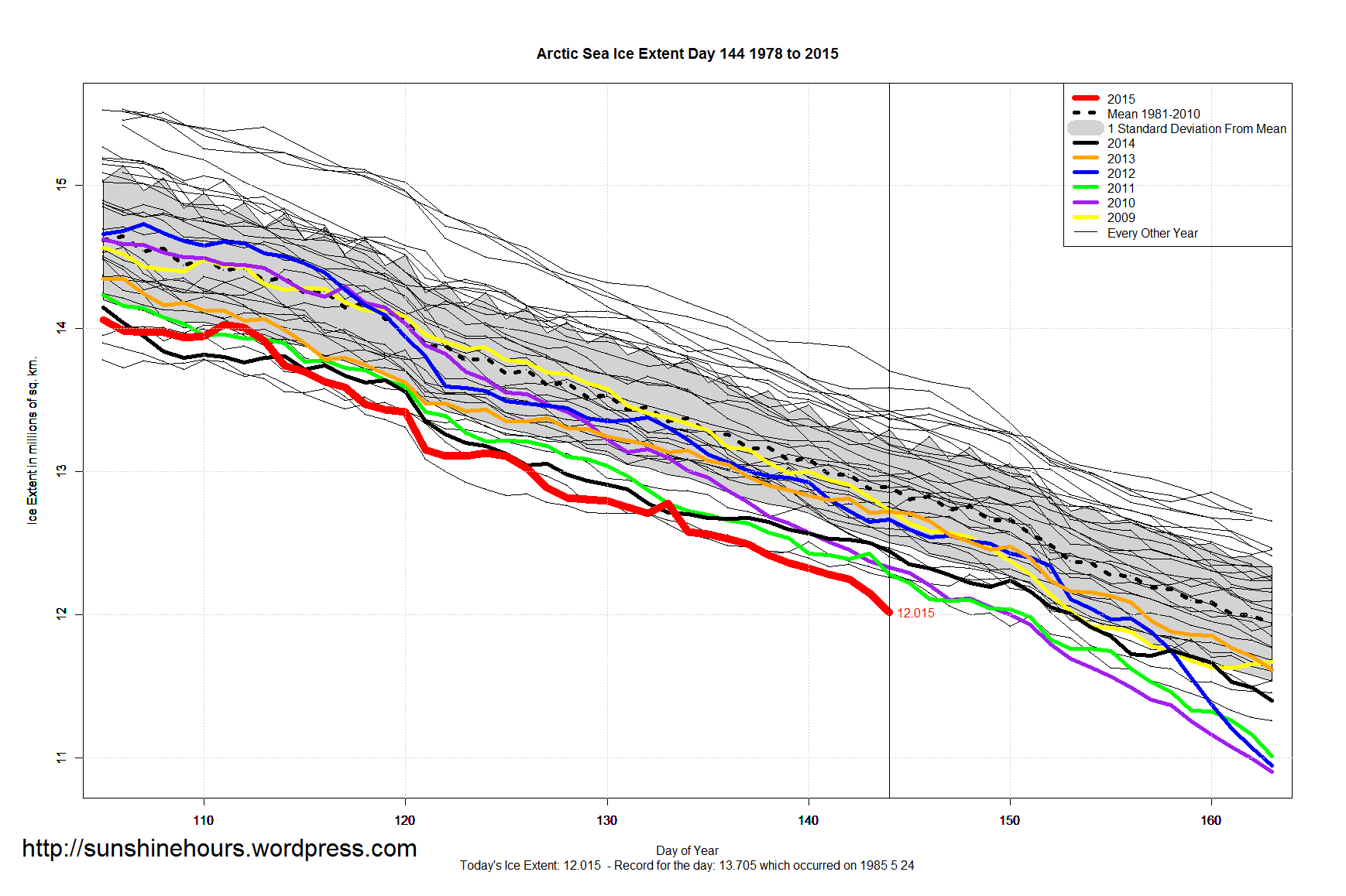

2015 Arctic ice extent keeps pace with 2014 despite the “Blob”.
https://rclutz.wordpress.com/2015/05/12/arctic-ice-watch-2015-2/
That arctic ice is record level low though, right?
Hi there. Please, don’t take my comment as an offense, I really just want to know, why is your Arctic info so much worse in relation to previous years than the official one from NOAA?
Thanks in advance!
It seems there is no 2015 on the embedded graph above… Here is a screenshot:
I use an NOAA data product. IMS uses a different methodology and sensors.
I believe IMS is more interested in ice edge. The NOAA product I use (ftp://sidads.colorado.edu/DATASETS/NOAA/G02135/north/daily/data)
http://nsidc.org/data/seaice/data_summaries.html
Thank you for clarification
IMS is the same as MASIE, which stands for Multisensor Analyzed Sea Ice Extent, It includes microwave sensor results, but also satellite imagery and ship observations. This leads to some differences in numbers but similar patterns.
The two histories are summarized here:
https://rclutz.wordpress.com/2015/03/30/everything-you-wanted-to-know-about-measuring-arctic-ice-but-were-afraid-to-ask/
Thanks Ron.