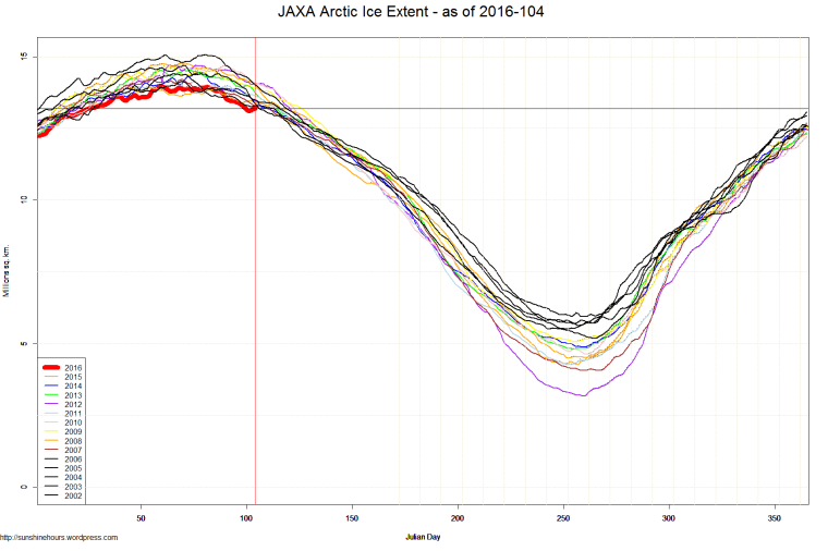
If you have been following this blog, you know the NSIDC satellite data has been very bad. Off by millions of sq km.
So I will be posting graphs for sea ice extent using data from JAXA (only goes back to 2002).

If you have been following this blog, you know the NSIDC satellite data has been very bad. Off by millions of sq km.
So I will be posting graphs for sea ice extent using data from JAXA (only goes back to 2002).

Will you ever be able to go back to the old data set with deeper history?
I hope so. But there may be gaps.