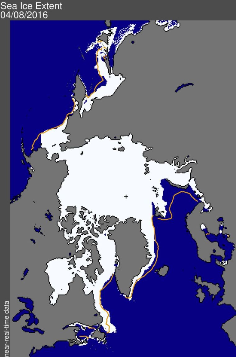
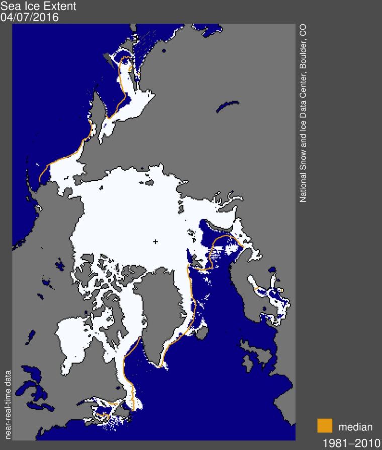
Antarctic Sea Ice Area (difference between Area/Extent here). Data for Area here.
The data for Area is usually 3 days old than the data I use for Extent. (But the Extent data is crap lately )
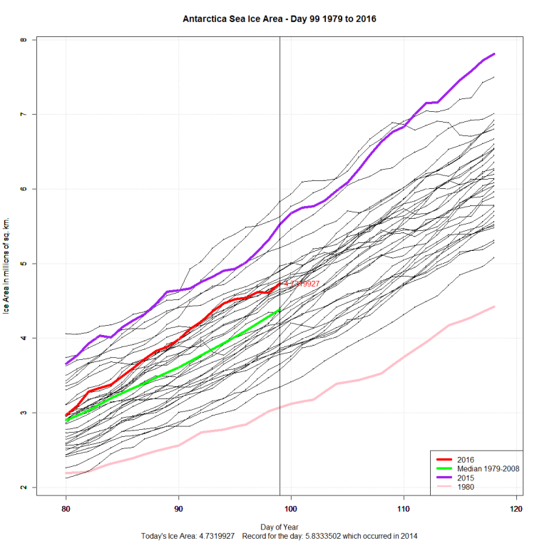
I have no idea what is the right data. The NSIDC says:
“The daily sea ice extent images are sporadically displaying erroneous data. NSIDC is investigating with our satellite data providers.”
After they fix the satellite I’ll have to decide whether to snooth the data or leave it as is. Maybe I’ll have a poll!


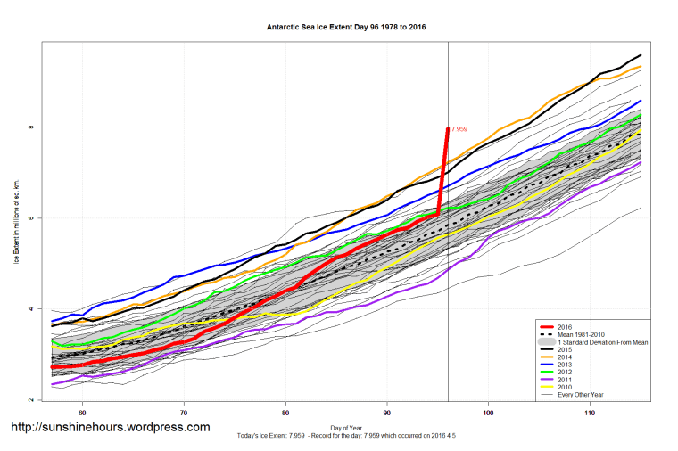
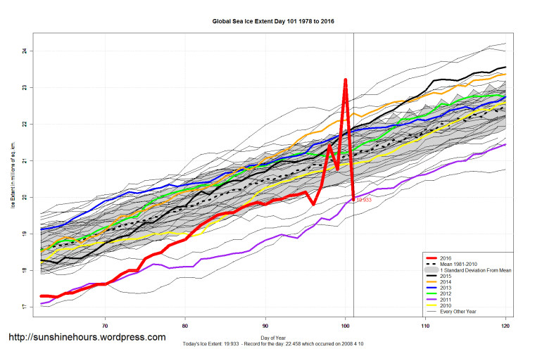
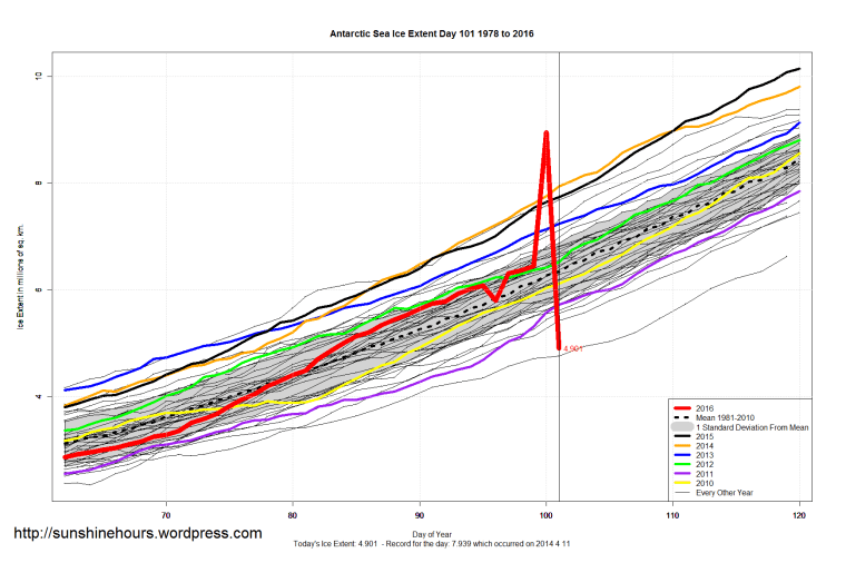
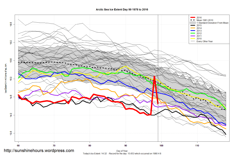
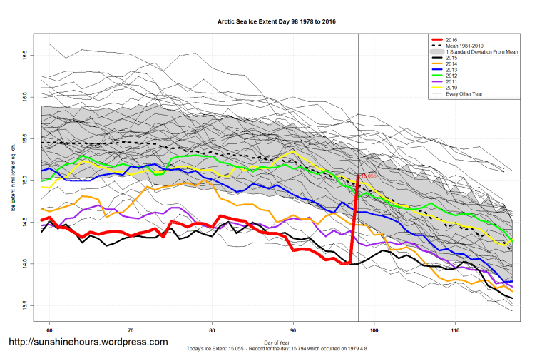
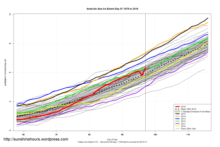
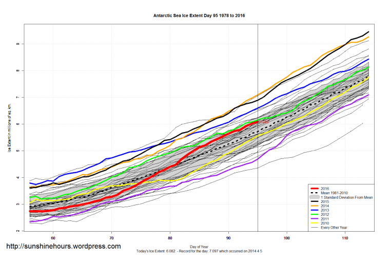
UPDATE 2: They updated the data, at 3:22 down to 5.786 (which is a 300,000 sq km drop from the day before. Not likely.
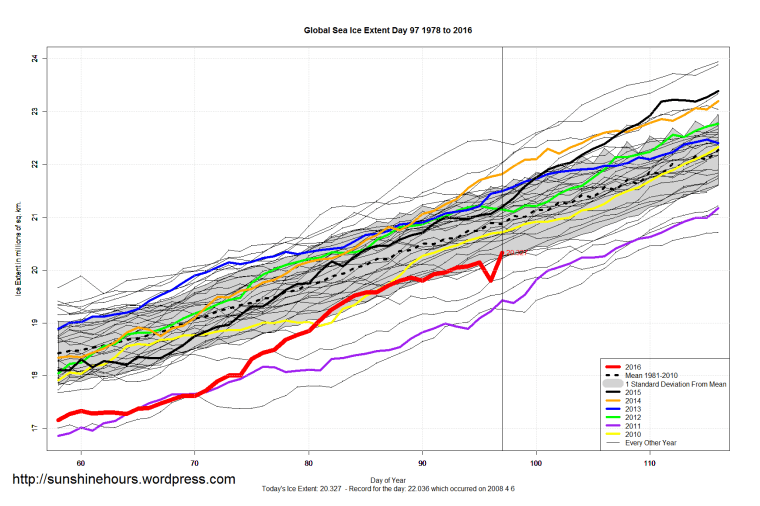
On day 96 the Antarctic sea ice extent took an unlikely jump from 6.082 million sq km to 7.959.
Sometimes they correct it the next day. Sometimes they don’t.
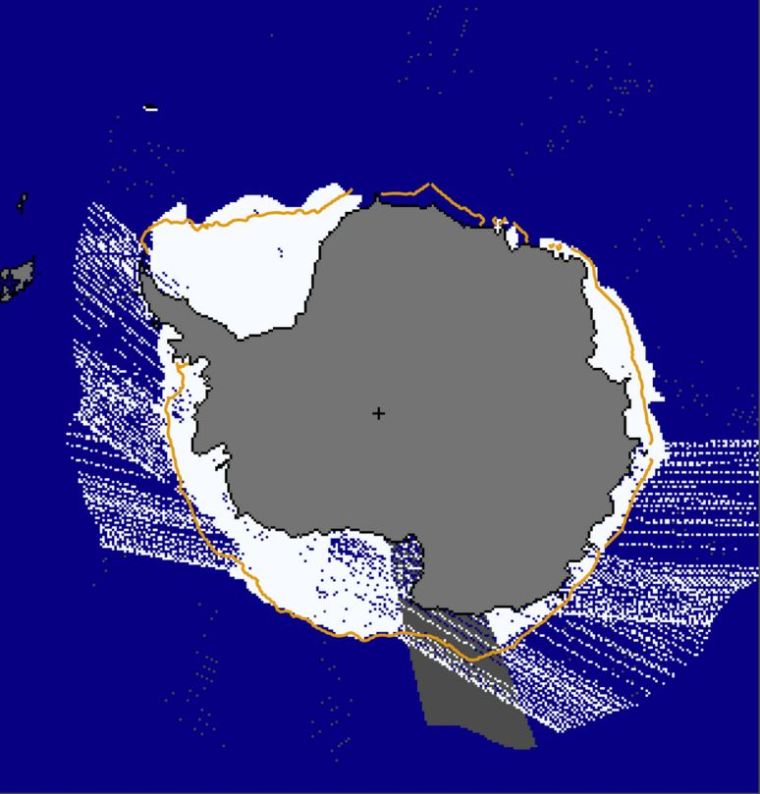
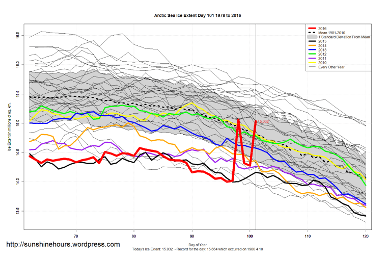
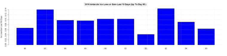
UPDATE: The “stuttering” in the daily Antarctic image. (Thanks AZ1971)