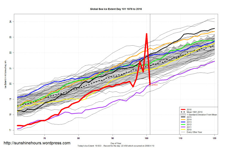
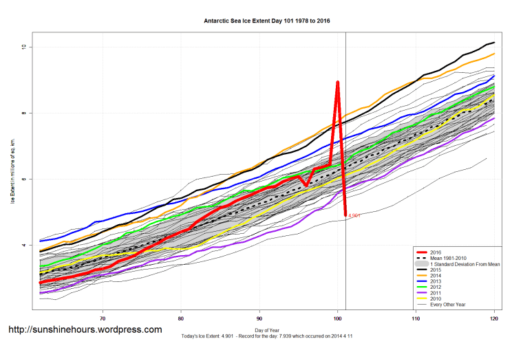
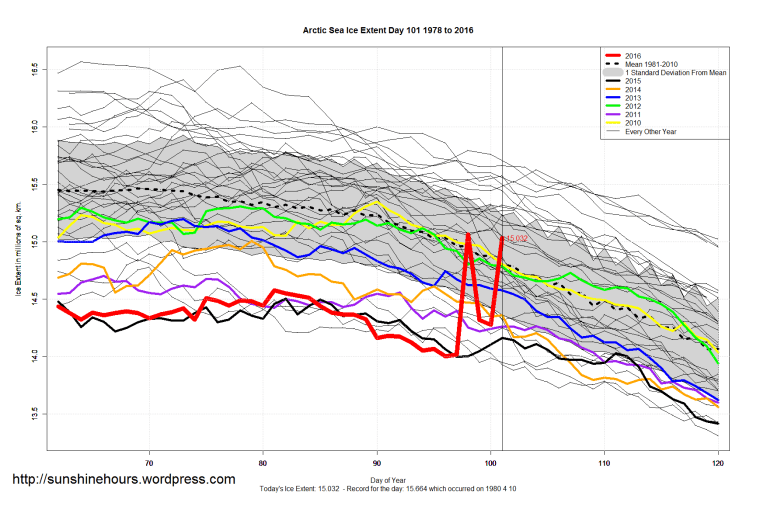
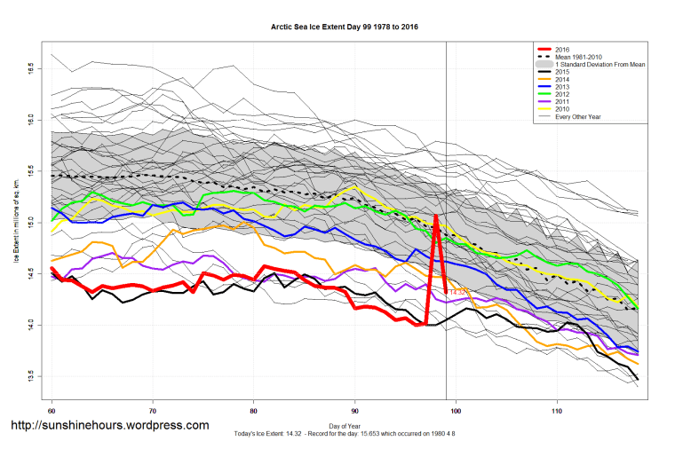
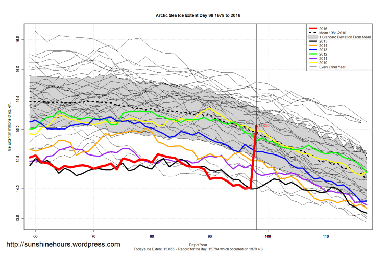
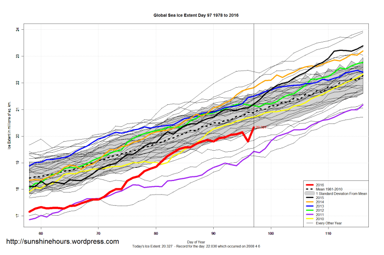
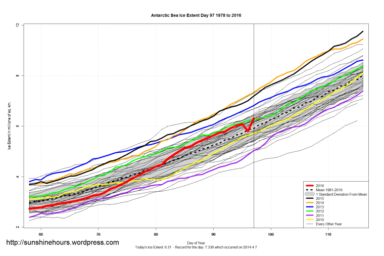
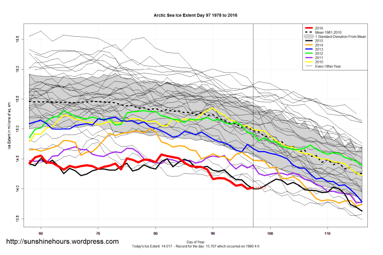
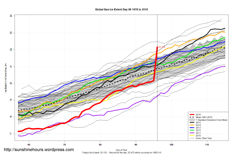
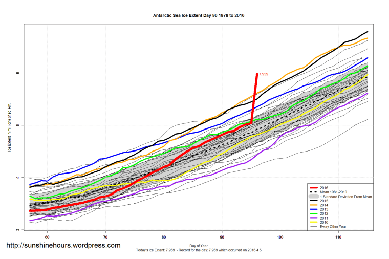
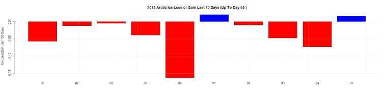
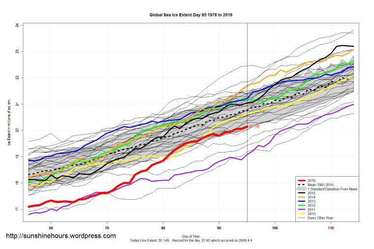
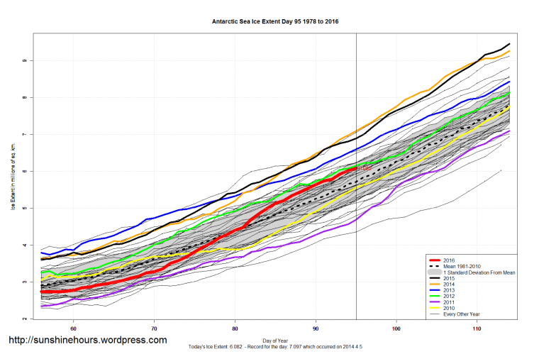
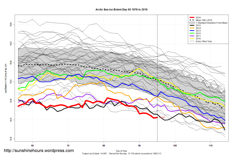
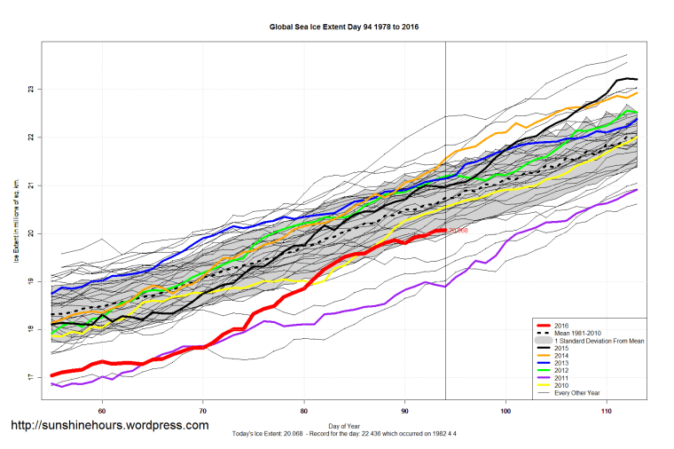
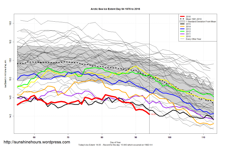
I have no idea what is the right data. The NSIDC says:
“The daily sea ice extent images are sporadically displaying erroneous data. NSIDC is investigating with our satellite data providers.”
After they fix the satellite I’ll have to decide whether to snooth the data or leave it as is. Maybe I’ll have a poll!