I’ve been dabbling in the USHCN data to see how much is Estimated and how much is Real. You can read more here.
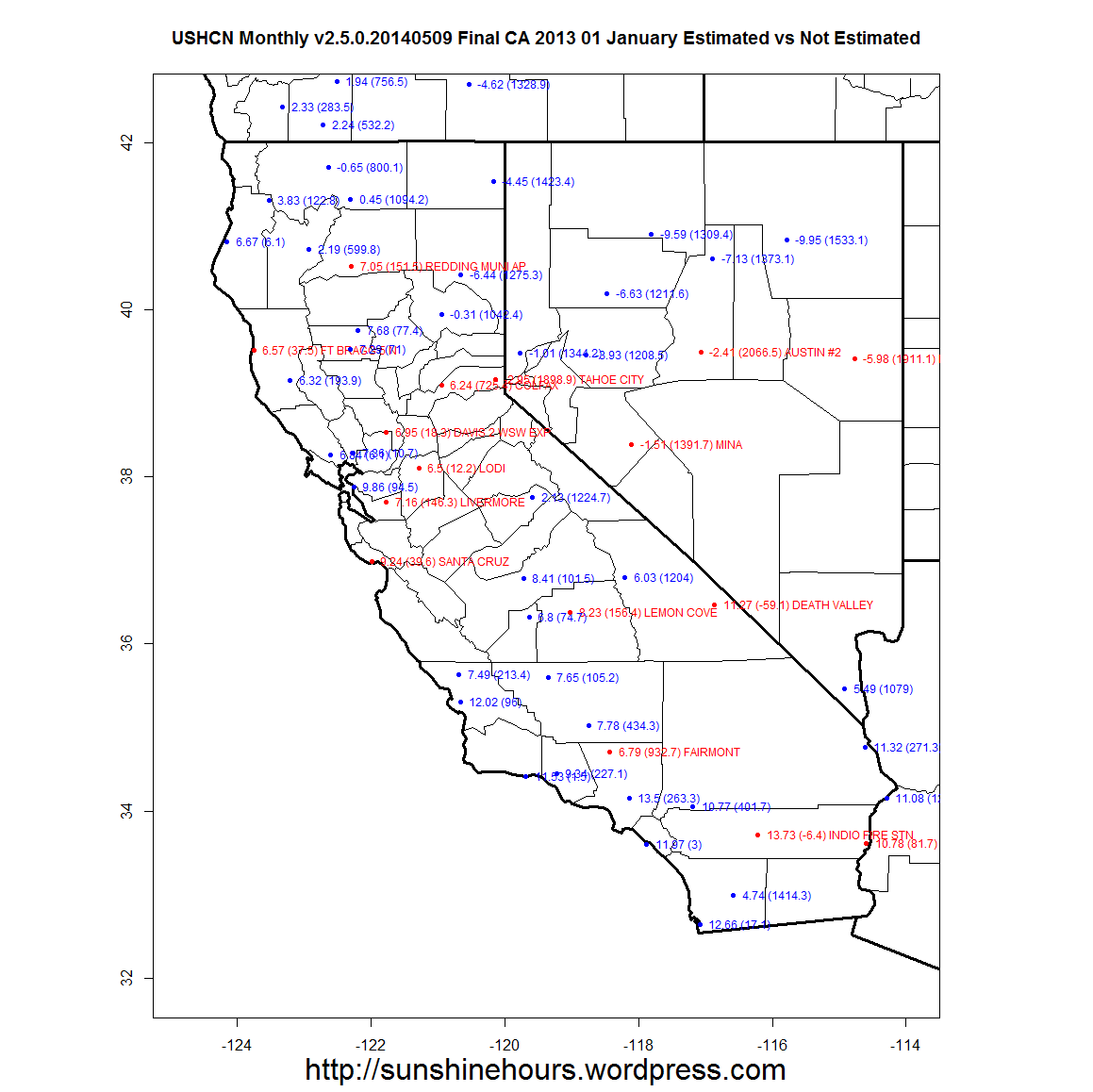
This is California (Nevada is there because of the shape of California) for the 12 months of 2013. The red stations (with name and elevation) are Estimated. The blue stations (no name to save space) are “real“.
For just California December 2013, 18 out of 43 are Estimated. The Estimated stations average 8.12C and the “Real” stations average 7.02. Click image for full size.

What do they estimate the data??
Sorry, Why do they estimate the data?
Because it is missing or the station no longer is in the current location. And probably other reasons too.